Use Cases
Track Progress
Drone mapping provides regular snapshots of a location over time, helping monitor development, construction, or natural changes without needing on-site visits.
Enhanced Communications
The clear visuals and data from drone mapping make it simple to present ideas, show conditions, or report findings to clients, stakeholders, or crews.
Take Measurements
Drone mapping generates 3D models and elevation data to analyze landscapes, calculate stockpile volumes, or assess slopes, helping with tasks like construction or resource management.
Support Decision-Making
By offering detailed data like maps or 3D models, Foxtrot Studios helps teams plan actions, allocate resources, or solve problems with confidence.
Data Deliverables
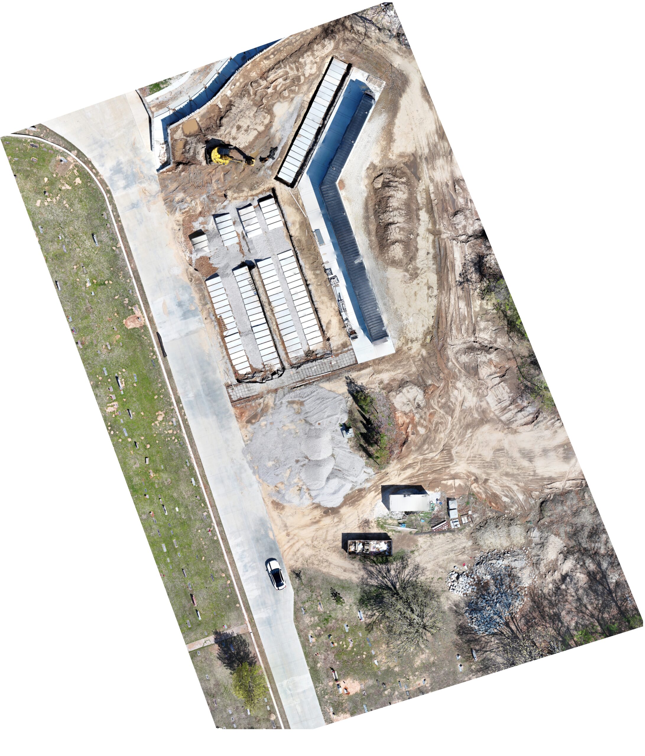
Orthomosaic
An orthophoto, or orthomosaic, is a georeferenced, distortion-corrected 2D map created by stitching together multiple aerial images. It provides a highly detailed, top-down view of the area, with consistent scale and perspective, making it ideal for accurate measurements and mapping.
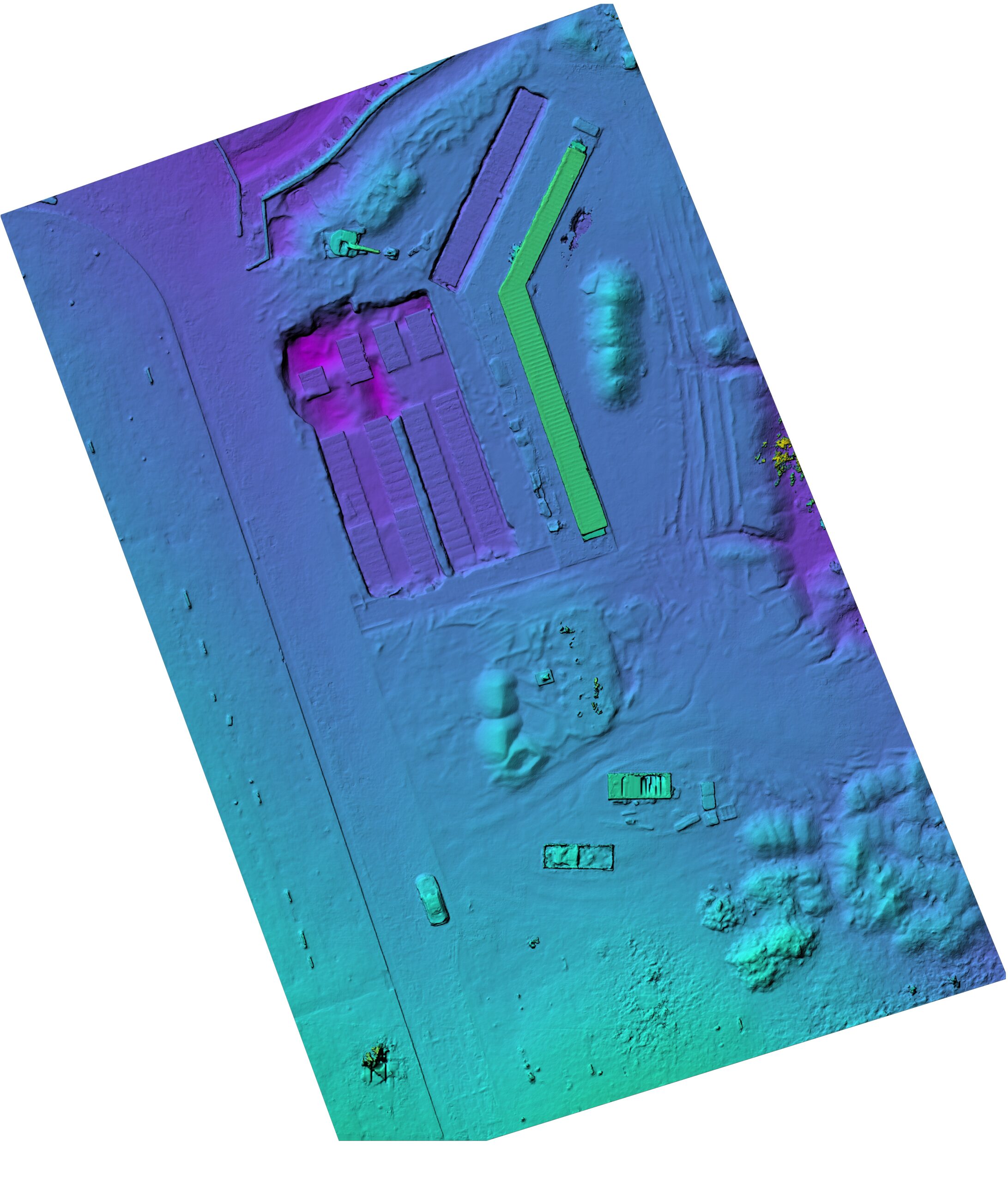
Digital Surface Model (DSM)
A DSM is a 2D dataset representing the elevation of the Earth’s surface, including all objects like buildings, trees, and other structures. It captures the height of everything visible from above, providing a topographic model of the area.
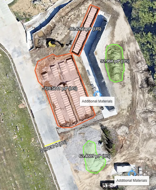
Volume Measurements
Volume measurements calculate the volume of stockpiles, cut/fill areas, or other features. This provides precise volume estimates for material stockpiles, excavations, or earthworks, helping clients manage resources, estimate costs, or track project progress.
How Accurate Are Our Maps?
Our drone mapping services are designed to provide high-quality, reliable data for planning, visualization, and project monitoring purposes. Utilizing advanced photogrammetry software, we transform aerial imagery into detailed maps and models. In typical projects, our maps generally achieve a relative accuracy within a range of a few centimeters to one meter. This level of precision is sufficient for most planning and monitoring applications, such as site overviews or progress tracking.
Common Questions
The timeline depends on the size and complexity of the area being mapped. Typically, a project involves less then a couple hours of flight and data collection, followed by a few hours of processing, depending on the deliverables requested. We’ll provide an estimated timeline when we discuss your project details.
We can map a wide range of areas, including construction sites, agricultural fields, and natural landscapes, as long as the location complies with local drone regulations. You do not need to be on-site during the flight, though we may coordinate with you to ensure access and safety requirements are met.
Yes, we adhere to all applicable drone regulations, including obtaining necessary permits and following airspace restrictions. Our operators are certified (FAA Part 107 Licensed) to ensure safe and legal operations. We’ll handle all compliance requirements for your project.
Absolutely. We customize our services to meet your needs, whether you require a simple 2D map, a detailed 3D model, or specialized outputs like volume calculations. Let us know your goals, and we’ll recommend the best deliverables for your project.
We can schedule follow-up flights to update your maps or monitor changes over time. This is particularly useful for tracking progress on construction sites or monitoring environmental changes. We’ll store your project data securely to ensure consistency between mapping sessions.
Disclaimer
The maps, models, and data provided through our drone mapping services are for informational and planning purposes only. They are not intended for legal, surveying, or official boundary determination uses. For legal or survey-grade accuracy, please consult a licensed surveyor or relevant professional.
Estimate Service Cost
This is just an estimate and final cost may vary!